After checking out the information in the English Heritage booklet, with the hope of seeing some, any, or at minimum one of the many heritage sites between Cornwall and South Gloucestershire, I realised that when visiting the UK in winter, you either have to accept that you probably won't see much, or you should plan everything around the weekends only - from November to March everywhere is open only on Saturday and Sunday; a risk I knew of and took, so can't really complain - although it's a little disappointing that absolutely nothing was open.
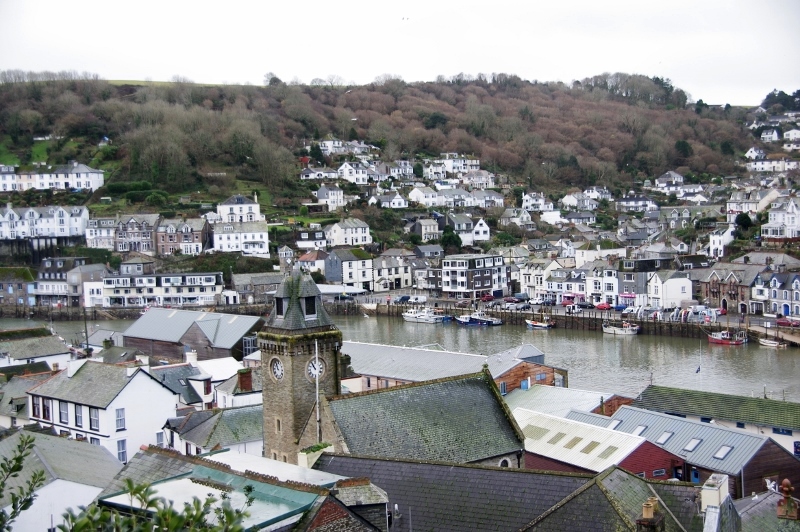
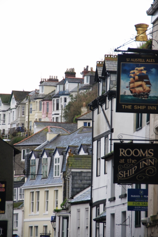
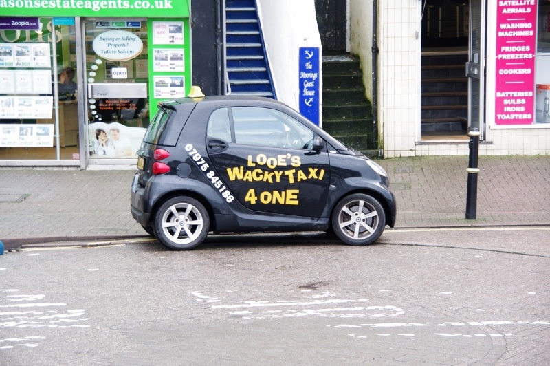
On Tristan's suggestion, rather than heading straight back from Cornwall to Marshfield, we took a circuit route (well, really there and back) to Looe (west of Saltash) - a typical Cornish fishing village / seaside resort; originally two distinct towns of East Looe and West Looe, and joined by a bridge over the River Looe, Looe is now one town, made up of East Looe and West Looe.
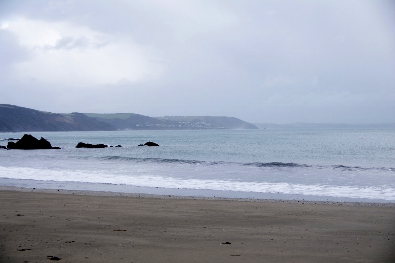
Looe (Cornish: Logh, meaning deep water inlet) is certainly scenic, with views of the village hugging the hillsides and along the rugged coastline.
Then back in the car, with the intention of heading to Yeovil (Somerset), passing through West Coker (to say "hi" for Carrie back home - which I did), then up nearby Ham Hill for panoramic views, and a leisurely return to Marshfield by early afternoon.
On Tristan's suggestion, rather than heading straight back from Cornwall to Marshfield, we took a circuit route (well, really there and back) to Looe (west of Saltash) - a typical Cornish fishing village / seaside resort; originally two distinct towns of East Looe and West Looe, and joined by a bridge over the River Looe, Looe is now one town, made up of East Looe and West Looe.
Looe (Cornish: Logh, meaning deep water inlet) is certainly scenic, with views of the village hugging the hillsides and along the rugged coastline.
Then back in the car, with the intention of heading to Yeovil (Somerset), passing through West Coker (to say "hi" for Carrie back home - which I did), then up nearby Ham Hill for panoramic views, and a leisurely return to Marshfield by early afternoon.
So first stop Looe, about 30 minutes from Saltash. I decided to park up the hill and walk into the village of East Looe, which gave great views, particularly of West Looe and the River Looe, and also gave a steep hike back up the hill to the car afterwards.
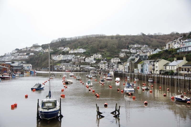
Looe is still a working fishing village, with many small boats pulled up alongside the quay. Clearly it has a fairly solid summer tourism trade, but that was understandably a little slow during my visit.
Looe is still a working fishing village, with many small boats pulled up alongside the quay. Clearly it has a fairly solid summer tourism trade, but that was understandably a little slow during my visit.
So, back in the car to head back to Marshfield, via West Coker and Ham Hill, both near Yeovil in Somerset.
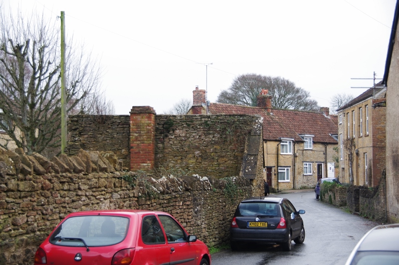
West Coker is the home village of Carrie back home, so I had to stop and say "Hi", as well as take a photograph; unfortunately, it was hard to find somewhere particularly photogenic, so sorry Carrie but you'll just have to accept the one below of Manor Street from the corner of High Street.
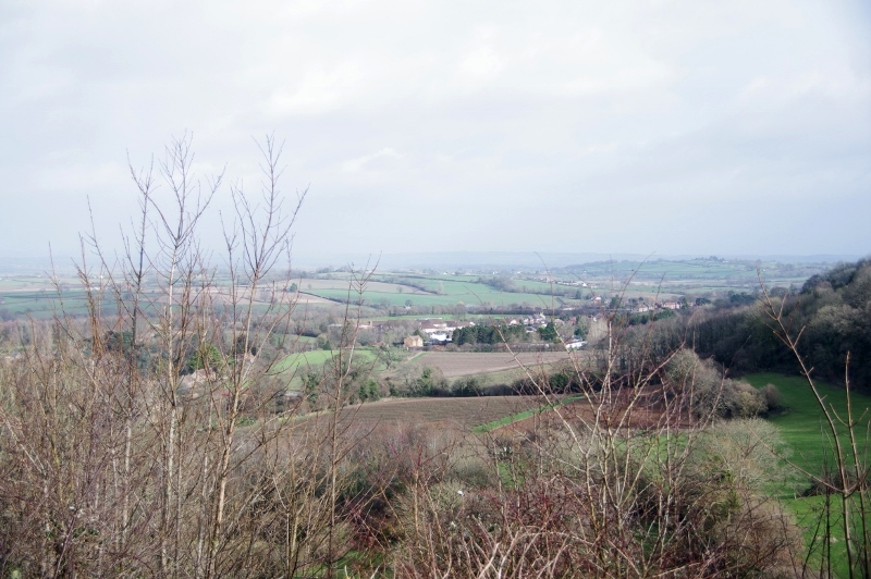
Carrie's mum (Rachel) had told me that Ham Hill is a famous and fantastic outlook, which I had to see if I was in the area. So, assuming that something that well-known would be well-signposted, I headed to Yeovil with a plan to find my way there - silly me! Fortunately I remembered that the village at the base of Ham Hill is Stoke-sub-Hamdon, so made my way there and found the track to the summit.
Ham Hill has a vast area at the top, but with the day fading, and the area very muddy, I didn't stay long, and I know that there is much more to see and experience. Ham Hill is the site of a Bronze Age and Iron Age hill fort and a Roman site - at 125m elevation and with the commanding views of the country in all directions, I'm really not surprised. There are some 5km of double bank and ditch ramparts, enclosing 85 hectares; at one end sits a war memorial, clearly visible from the M5.
West Coker is the home village of Carrie back home, so I had to stop and say "Hi", as well as take a photograph; unfortunately, it was hard to find somewhere particularly photogenic, so sorry Carrie but you'll just have to accept the one below of Manor Street from the corner of High Street.
Carrie's mum (Rachel) had told me that Ham Hill is a famous and fantastic outlook, which I had to see if I was in the area. So, assuming that something that well-known would be well-signposted, I headed to Yeovil with a plan to find my way there - silly me! Fortunately I remembered that the village at the base of Ham Hill is Stoke-sub-Hamdon, so made my way there and found the track to the summit.
Ham Hill has a vast area at the top, but with the day fading, and the area very muddy, I didn't stay long, and I know that there is much more to see and experience. Ham Hill is the site of a Bronze Age and Iron Age hill fort and a Roman site - at 125m elevation and with the commanding views of the country in all directions, I'm really not surprised. There are some 5km of double bank and ditch ramparts, enclosing 85 hectares; at one end sits a war memorial, clearly visible from the M5.
As the M5 was close, I assumed that it would be easy to pick this up at Taunton and head back to Marshfield relatively easily. However, the GPS had another idea - obviously it is a shorter distance to take the smaller A roads, so that's the way it insisted I head. As I have learnt, the shortest distance is often far from the shortest route!
After much wailing and gnashing of teeth, I saw a sign to either continue as my GPS would have me go, via Frome, or take another route via Bath / Bristol - as these are relatively major centres, and the road number only had 2 digits instead of the 3 on the road I was following, I thought that might prove a good way to go. I was wrong; not only were the roads no better, but now I was going longer distance, and to top it off, the GPS recalculated to go through the centre of Bath - not a good idea at all.
Finally, I reached Marshfield, and happiness returned. As I cruised along High Street, I knew that my journey was about to come to an end; however, just to top off the day, two school buses decided to stop right across Weir Lane (where I had to turn down) to disgorge numerous children coming home from school. However, a short wait and I was fortunately able to arrive safely back at Jenny & Craig's.
What was meant to be a reasonably easy 3 1/2 - 4 hours drive turned into a somewhat tiresome 5 hour drive (not counting the time out of the car). So, the first lesson from what we've learnt today - if you can possibly use an "M" road over an "A" road (even if it's reasonably significantly longer in distance) - just do it: go the distance! And our second lessons - on the "A" roads if there is a choice, take the one with the fewest number of digits!
Having said that, it was good to experience the real driving conditions, and to learn the lessons of the locals for myself.
After a quick shave and shower to feel human again, in the evening I joined Craig for dinner with Ryan and David at David's house, and then at their regular Monday night mens' circle at the Lighthouse in Frome, which was a good experience - thanks to Ryan, David, Jonathon, Otto and James for the warm welcome; I look forward to seeing you all again at the Retreat.
 RSS Feed